Asset management for larger teams
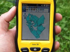
Harness the strength of your distributed team to provide geo-enabled data you can trust. With the Trimble® Juno® 3 series, your mobile workforce is empowered with a fully integrated, GPS-based data collection system for everyday field work. If your organization is managing critical assets, responding to emergencies or keeping an enterprise GIS current, you can increase efficiency—both in the field and in the office with dedicated asset management workflows and Juno 3 series handhelds.
Delivered in a compact package resistant to dust, water, and shock, the Juno 3 provides a complete, integrated package of positioning, imaging and communications for total flexibility day after day.
Choose either the Juno 3B or 3D model to suit your needs:
| Product Models | Juno 3B | Juno 3D |
| Cellular voice & data | No | Yes |
| Integrated camera | 5 MP | 5 MP with Flash |
The key to maximizing the productivity of your entire workforce everyday
The Trimble Juno 3 series is a compact integrated solution for your field workers, that will keep them connected and in touch.
As part of the Trimble family of GPS solutions, Juno 3 series handhelds are fully compatible with Trimble's entirerange of Mapping & GIS software, giving you a choice of GIS data collection and maintenance software solutions at a range of price points.
You can easily deploy Juno 3 series handhelds alongside your current Trimble equipment and maintain the same workflows and policies.
To discuss the benefits of using Trimble Juno 3 series handhelds, contact your local Trimble reseller.
KEY FEATURES
- Rugged IP54 rating for tough outdoor conditions
- Feature packed, fully integrated, affordable
- 3.75G cellular data and voice capability
- High-sensitivity GPS receiver
- 5 megapixel autofocus camera with flash
- Long life battery for all-day use
- Lightweight and compact
All in one mobile solution
Combining the benefits of a GPS device, camera, PDA, and cellphone, this pocket-sized device provides work teams with a range of tools in a single compact package, so there are fewer batteries to charge and fewer devices to manage.
With a camera at the ready, your teams can document exactly what they see in the field. The Trimble Juno 3 combines photos with GPS so photos can be instantly geotagged for future reference. In addition, field to office collaboration is dramatically improved because photos can be sent from the field for review back in the office.
For standard positioning applications such as navigation, the high-sensitivity receiver delivers optimal yield so you can get a position fast in the harshest conditions. 2 to 5 meter positional accuracy is always available in real time in regions with SBAS coverage. In addition, accuracy can be further improved to 1 to 3 meters through simple postprocessing routines to meet company or regulatory standards.
Designed for GIS workflows and distributed teams
In GIS environments, data integrity and standardization is critical to maintain total workflow efficiency. Professional, geo-enabled data collection requires dedicated field software. The Trimble Juno 3 series is optimized for Trimble and other industry standard field software, so you can be confident that the data you receive back in the office is exactly what you need for streamlined integration into your enterprise GIS and fast updates.
- Juno 3 series webinar
- Supported wireless carriers/cellular phones
- Find the closest Trimble reference station
- GPS tutorial


